A major challenge in effective climate adaptation is the lack of sufficient data and understanding of diverse climatic and geographic conditions. Within SCORE, this challenge was addressed through the generation of high-resolution climate and sea level projections tailored to local coastal challenges. To generate these models, all the CCLLs worked with local stakeholders to improve data availability, understand high risk areas, amongst others.
Local Perspectives on Coastal Erosion
In Sligo CCLL, the community faces significant climate challenges, specifically coastal erosion and flooding. Stakeholder engagement has been central to Sligo CCLL’s success. Workshops involving local authorities, environmental agencies, and community groups helped identify gaps in coastal risk assessments. These sessions underscored the urgent need for improved storm surge forecasting and extreme sea level predictions, particularly in areas previously understudied in Sligo. With these insights in hand, and concerns about the coastal erosion and flooding, Sligo CCLL developed relevant computational models.
Citizen Science Initiatives
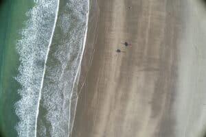
Shoreline erosion studies were conducted using the CoastSat model, analysing historical satellite images to track shoreline changes over time. To improve accuracy, drone surveys and the SCORE Photobooth Coastal Initiative were introduced. This initiative, co-developed with Dublin CCLL, allows citizens to contribute real-time shoreline images, creating a unique dataset that enhances scientific research. The crowdsourced data is especially valuable in areas where satellite imagery is limited due to cloud cover or resolution constraints.
Coastal flooding and storm surge forecasting have also been key priorities. Using advanced hydrodynamic models, Sligo simulated storm surges and predicted extreme sea levels. These models are supported by locally deployed water level sensors that provide real-time monitoring of sea levels. The collected data is accessible through a mobile app, making it easier for citizens and stakeholders to track flooding risks. Additionally, GIS and mapping software have been used to generate detailed flood forecast maps, giving authorities and communities a clearer understanding of high-risk areas.
“ There are people on the academic side of things doing some really exciting research that is important to show to the other stakeholders. From where I am, in the local authority, being able to bring the academic side to the community, to the ground; being able to be that link has been a privilege and something really useful to me.” – Pete Murtagh, Sligo County Council, Sligo CCLL
By integrating multiple data sources, satellite imagery, drone surveys, low-cost sensors, and citizen science, Sligo CCLL has developed a comprehensive coastal monitoring system. This approach provides policymakers, urban planners, and researchers with accurate, real-time data to support climate resilience and sustainable coastal management. Key achievements include the creation of baseline erosion maps for northwest Ireland, the identification of high-risk areas, and the development of storm surge forecasting models essential for disaster preparedness. At the same time, the initiative has strengthened knowledge-sharing between researchers and local communities, ensuring a more collaborative and informed approach to coastal adaptation.